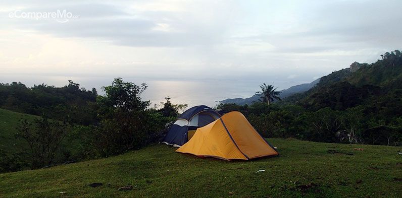
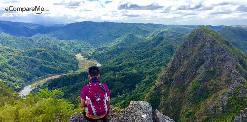
Top Hiking Spots In The Philippines: 20 Mountains To Climb
35 min readThis list of top hiking spots in the Philippines will take you to some of the most physically challenging and beautiful mountains in the country.
Mountain climbing in the Philippines has become more popular over the years, thanks mainly to social media influencing a growing number of enthusiasts. It’s a feat that’s rewarded with breathtaking views, and life-lessons on patience and perseverance. It’s one of those meaningful activities that, once started, will surely awaken the adventurer within.

If you’ve also been feeling that “the mountains are calling, and I must go†like John Muir, here are 20 of the best hiking spots in the Philippines for you to dream about seeing.
The list includes valuable details for each climb such as sample travel itineraries, an estimated budget, and how much water to bring. Let’s go!
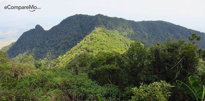
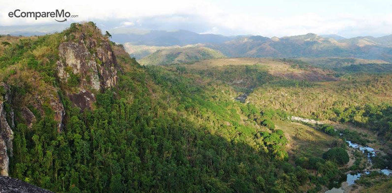
1. Mt. Daraitan
Difficulty level: 4/10
Jump Off: Brgy. Daraitan (village center), Tanay
Hike: 2.5 to 4 hours
Water load: At least 2 liters
Situated on the border of Tanay, Rizal and General Nakar, Quezon, just at the heart of the Sierra Madre Mountain Ranges is Mt. Daraitan
Home to green grasslands, abundant forest trails and caves, it also contains one of the most pristine rivers in the country, the Tinipak River.
How to get there:
Via public transportation:
- You can ride a van in front of Starmall going to Tanay or a jeepney along Shaw Boulevard.
- Alight at Jollibee Tanay and take a tricycle going to Barangay Daraitan registration site.
Via private transportation:
- You can drive to Tanay taking Ortigas Extension to Rizal Provincial Road, Roman Rojas Road, and Marikina-Infanta Highway or Marilaque Highway or R-6 to Tanay tracing the way to Laguna.
- Turn left to Makaira — Daraitan Road then drive all the way until you see the registration hall which is situated several meters pass the river.
Sample itinerary:
| Time | Activity |
|---|---|
| 4:00 AM | Estimated time of departure from Manila |
| 5:00 AM | Estimated time of arrival at Jollibee Tanay (for those taking public transport) |
| 6:00 AM | Estimated time of arrival at Barangay Daraitan registration site |
| 6:30 AM | Start of trek |
| 11:00 AM | Estimated time of arrival at the summit |
| 12:00 AM | Lunch/Descent |
| 1:00 PM | Begin traverse to Tinipak River |
| 4:00 PM | Estimated time of arrival at the Tinipak River and Cave |
| 5:00 PM | Preparation for descent |
| 6:00 PM | Hike back to the registration site |
| 7:00 PM | For those taking public transportation: Trike/Jeep back to Tanay Terminal |
| 8:00 PM | Estimated time of arrival at Tanay Terminal. Departure for Manila |
| 9:00 PM | Estimated time of arrival in Manila |
Expenses:
| Expense | Amount |
|---|---|
| Roundtrip fare from Manila to Tanay | P140 |
| Roundtrip trike fare from Tanay to Brgy. Daraitan | P500 per trike (Trike capacity 5 pax) |
| Registration/Environmental Fee | P20 |
| Tinipak River fee | P20 |
| Guide fee (Note: every 5 people need one guide) | P750 for 5 pax |
| Misc (food, etc.) | P100 |
| TOTAL | P480 |
2. Mt. Gola
Difficult: 2/9
Jump Off: Brgy. Bayukbok, San Miguel, Bulacan
Hike: Half day
Water load : At least 2 liters
Planning to take a breather and climb mountains but still don’t know where to start? If you’re into a quick weekend adventure that involves spelunking, swimming, and trekking, a hike to Mt. Gola is definitely something to try.
Located in Brgy. Sibul, San Miguel, Bulacan, Mt. Gola is perfect for beginners who are up for some adventure. One of the attractions of this climb is you’ll have the chance to experience a twin hike at Mt. Manalmon who happens to be on the same area as Mt. Gola.
With a 2/9 level of difficulty, brace yourselves for a quick and easy yet rewarding hike.
How to get there:
Via public transportation:
-
- From the Cubao bus terminal, ride a Golden Bee or Baliwag Transit bus going to San Miguel, Bulacan.
- Alight at the intersection going to Sibul (after Camias).
- Ride the tricycle going to Madlum. The registration area is located just across the bridge.
Via private transportation:
-
- Drive your way through North Luzon Express Way (NLEX) and take Sta. Rita Exit.
- Follow the road to Cagayan Valley, passing by Plaridel ->Pulilan ->Baliuag -> San Rafael and San Ildefonso, Bulacan.
- At San Miguel, ask directions for Brgy. Madlum which is 30 minutes away.
Itinerary
| Time | Itinerary |
|---|---|
| 3:00 AM | Estimated time of departure from Manila |
| 5:00 AM | Estimated time of arrival at Sitio Madlum, Brgy. Sibul San Miguel Bulacan |
| 6:00 AM | Estimated time of arrival at jump-off, breakfast, orientation |
| 7:30 AM | Start of trek |
| 9:00 AM | Estimated time of arrival at the summit, photo-ops |
| 10:00 AM | Descent to registration area |
| 11:00 AM | Arrival at registration area, lunch |
| 12:30 AM | Freshen up and prepare for trip back to Manila |
| 2:00 PM | Estimated time of departure to Manila |
| 4:00 PM | Estimated time of arrival in Manila |
Budget:
| Expense | Amount |
|---|---|
| Roundtrip bus fare | P234, 117 one way |
| Tricycle ride | P240 one way for 3 pax |
| Registration fee | P20 |
| Environmental fee | P10 |
| Tour guide fee | P300 for 9 pax |
| TOTAL | P459 |
(Read:Â 4 Destinations In The Philippines Where You Could Really Use Travel Insurance)
3. Mt. BatulaoÂ
Difficulty: 4/10
Jump Off: KC Hillcrest Evercrest Golf Course, Nasugbu
Hike: 9 to 11 hours
Water load: At least two liters
If you need to take a break from the city life, try mountain climbing at Mt. Batulao. Located in Nasugbu, Batangas, it’s definitely one of the best hiking spots in the Philippines. Molded intricately into various shapes and sizes, Mt. Batulao is indeed a marvelous work of nature.
After hiking a spectacular boulder formation for two to three (2-3) hours, you’ll see its gorilla-shaped ridge line unravel near the summit. And as soon as you reach the top, you will be welcomed by a stunning 360-degree view of Batangas city and its neighboring cities.
How to get there:
Via public transportation:
- At Buendia Bus Station, ride a DLTB bus bound to Nasugbu, Batangas.
- Alight at Evercrest (KC Hillcrest Golf Club).
- Ride a tricycle or walk towards the registration point.
 Via private transportation:
- From Manila, make your way to Tagaytay via SLEX.
- Take Greenfield Exit then proceed via the Tagaytay-Nasugbu Road until you reach Evercrest.
- Go past the gate, follow through, turn left at the fork, and then go down the rough road to the trailhead.
Or
- Follow your way going to Tagaytay via Cavitex or SLEX.
- At the intersection in Olivares, follow the way going to Nasugbu.
- Turn left at Evercrest (KC Hillcrest Golf Club).
- Take the first right then drive straight until you see the parking area.
Sample itinerary:
| Time | Activity |
|---|---|
| 4:00 AM | Estimated time of departure from Buendia Bus Station |
| 6:00 AM | Estimated time of arrival at Evercrest |
| 6:30 AM | Start of trek |
| 7:30 AM | Rest station then proceed to old trail |
| 8:30 AM | Estimated time of arrival at old trail registration site |
| 9:00 AM | Begin trek to the summit |
| 10:30 AM | Estimated time of arrival at the summit |
| 11:30 AM | Estimated time of departure from the summit to Camp 8 |
| 12:30 PM | Estimated time of arrival at Camp 8 Registration Site |
| 1:00 PM | Estimated time of departure from Camp 8 to Evercrest |
| 3:30 PM | Estimated time of arrival at Evercrest. Wash-up and prepare for the trip back to Manila |
| 5:00-5:30 PM | Take bus back to Manila |
Expenses:
| Expense | Amount |
|---|---|
| Roundtrip bus fare from Buendia to Evercrest | P222 |
| Registration fee for Old and New Trails | P60 |
| Guide Fee | P500 for 5 pax |
| Toilet and bath fee | P25 |
| Trike fare (optional) | P100 for 3 pax |
| TOTAL | P450 |
4. Mt. UlapÂ
Difficulty: 4/10
Jump Off: Ampucao, Itogon, Benguet
Hike: 4 to 6 hours
Water load: At least two liters
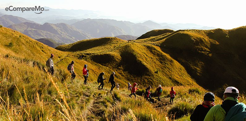
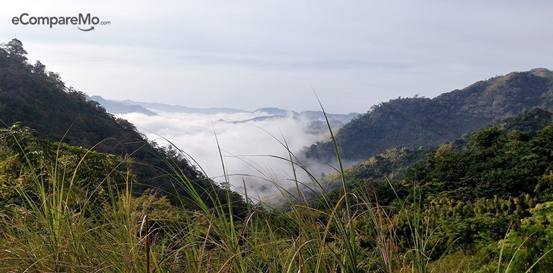
Mt. Ulap’s trail spans around 8 kilometers, at the end of which is a spectacular view of the Cordilleras. As you trek through the pine and grassland ridges, you’ll also get to marvel at the Igorot culture, as you pass by their burial caves and hanging bridges.
In good weather, hiking through Mt. Ulap can also reveal a scenic view of three different mountains included in this list of Top 20 Best Hiking Spots in the Philippines, Mt. Arayat, Mt. Pulag, and Mt. Ugo.
 How to get there:
 Via public transportation:
- Ride a bus in Cubao or Pasay, bound for Baguio City.
- From the bus terminal, ride a jeep going to Central Mall.
- Ride another jeep en route Phillex Mines and alight at Ampucao Elementary School.
 Via private transportation:
- Drive to NLEX then continue your way to SCTEX.
- Take the exit to MacArthur Highway.
- From MacArthur Highway, turn right at Kennon Road continuing to Loakan Road.
- Take Balatoc Road until you reach Ampucao Elementary School.
Sample itinerary:
| Time | Activity |
|---|---|
| 2:00 AM | Estimated time of arrival at Ampucao Elementary School |
| 3:30 AM | Start of trek |
| 4:00 AM | Estimated time of arrival at Ambanao Paoay |
| 5:00 AM | Estimated time of arrival at Gungal Rock |
| 6:00 AM | Estimated time of arrival at the summit |
| 8:30 AM | Estimated time of arrival at Pong-ol human cave |
| 9:30 AM | Estimated time of arrival at Sta. Fe. Wash-Up area |
| 10:00 AM | Leave for Baguio City |
| 10:30 AM | Arrive at Baguio City |
| 7:00 PM | Leave Baguio City bound for Manila |
| 12:00 AM | Estimated time of arrival in Manila |
Expenses:
| Expenses | Amount |
|---|---|
| Roundtrip bus fare from Manila to Baguio | P600 |
| Roundtrip jeepney fare at Central Mall | P18 |
| Roundtrip jeepney fare at Ampucao | P70 |
| Registration fee | P50 |
| Camping site fee | P80 for 8pax and below |
| Guide fee | P60 per person |
| Porter fee (optional) (20kg max per porter) |
Day hike: P500 Overnight hike: 800 |
| TOTAL | P1,368 |
5. Mt. DaguldolÂ
Difficulty: 4/10
Jump Off: Brgy. Hugom, San Juan Batangas
Hike: 5 to 6 hours
Waterload: At least 2 liters
This mountain offers more than just your typical mountain climbing activities, with the option of taking a dip in the sea after the hike.
Hiking on Mt. Daguldol, which is 670 meters above sea level, you’ll pass by a series of streams and – by going off trail a bit – waterfalls. Perfect for those who want to cool down.
Upon reaching the summit, the spectacular view of Batangas and Mindoro will blow you away. It is, without a doubt, worthy of its place in the Top 20 Best Hiking Spots in the Philippines.
How to get there:
Via public transportation:
- At Buendia Bus Station, ride the Alps Bus Liner Bus going to San Juan, Batangas.
- From San Juan Bus Station, ride a jeepney going to Brgy, Hugom. You can also take a tricycle going to the barangay hall of Brgy. Hugom.
- Alight at Brgy. Hugom barangay hall and take a tricycle ride going to Mt. Daguldol.
Via private transportation:
- Drive your way through SLEX and take Ibaan Exit.
- Turn left to San Juan, Batangas and drive pass Laiya until you reach Hugom.
Sample itinerary:
| Time | Activity |
|---|---|
| 3:00 AM | Estimated time of departure from Manila |
| 5:00 AM | Estimated time of arrival at San Juan, Batangas |
| 5:45 AM | Estimated time of arrival at Brgy. Hugom |
| 6:00 AM | Estimated time of arrival at the trailhead and registration site |
| 6:30 AM | Start of trek |
| 9:00 AM | Estimated time of arrival at Mang Lizardo’s Place |
| 10:30 AM | Estimated time of arrival at the summit |
| 11:00 AM | Begin descent |
| 1:00 PM | Estimated time of arrival at the trailhead |
| 4:00 PM | Head back to San Juan, Batangas |
| 9:00 PM | Estimated time of arrival in Manila |
Expenses:
| Expense | Amount |
|---|---|
| Bus fare from Manila to Batangas | P191 |
| Tricycle Fare to Brgy. Hugom | P70 |
| San Juan Ecological Fee | P20 |
| Tricycle fare from Brgy. Hugom to the trailhead | P100 |
| Guide Fee | P400 |
| Registration fee at the barangay | P35 |
| Bus from Batangas to Manila | P198 |
| TOTAL | P1064 |
(Read:Â Top Tourist Spots In The Philippines That Look And Feel Like Popular Foreign Destinations)
6. Mt. Maculot
Difficulty: 3/10
Jump Off: Mountaineer’s Store, Brgy. 7 “Sieteâ€, Cuenca, Batangas
Hike: 3.5 to 5 hours
Water load: At least 2 liters
Time to experience one of Batangas’ treasures, Mt. Maculot!
If you are looking for the perfect “Instagram-worthy†photo, hike your way Maculot’s Rockies. There you will find an impeccable view of the Taal Lake, and the rest of Batangas.
How to get there:
Via public transportation:
- At Buendia Bus Station, ride a bus bound to Lemery, Batangas.
- Alight at Poblacion (town center) along the highway.
- From there, you can either walk to the jump-off or take a tricycle. The tricycle will detour you to the Barangay Outpost.
 Via private transportation:
- From Manila, drive your way through SLEX and Star Tollway going to Batangas.
- Take your exit at Tambo, Lipa City.
- From Tambo exit, turn left taking JP Laurel Highway.
- Take a right turn before Phoenix Gas Station and drive straight through the National Highway going to Cuenca town proper.
- From the town proper, you can ask the locals, or you can use any navigating app.
- Set your destination to Mountaineer’ Store, Cuenca, Batangas.
Sample itinerary:
| Time | Activity |
|---|---|
| 6:00 AM | Estimated time of departure from Buendia bus station |
| 9:00 AM | Estimated time of arrival at Cuenca Poblacion Highway. You can either walk or take a tricycle to the jump-off |
| 9:30 AM | Begin trek |
| 11:15 AM | Estimated time of arrival at the campsite. Make your way to the Rockies |
| 11:30 AM | Estimated time of arrival at the Rockies. Photo-op. |
| 12:00 PM | Return to camp. Take lunch. |
| 12:30 PM | Begin descent |
| 2:00 PM | Estimated time of arrival at the jump-off. Wash-Up |
| 3:00 PM | Departure for Manila |
| 7:00 PM | Estimated time of arrival in Manila |
Expenses:
| Expense | Amount |
|---|---|
| Roundtrip bus fare from Buendia bus station to Lemery, Batangas | P350 |
| Roundtrip tricycle fare (optional) | P30 |
| Registration fee | P20 |
| Guide Fee | P1000 per 5 pax |
| TOTAL | P600 |
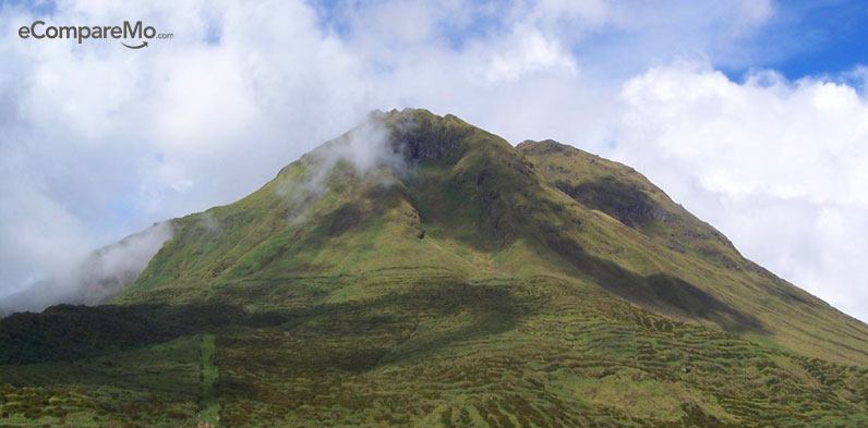
7. Mt. Pinatubo
Difficulty: 5/10
Jump Off: Capas, Tarlac
Hike: 6 hours trek 3 hrs 4×4 Roundtrip
Water load: At least 2 liters
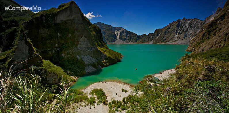
A decade after the 1991 volcanic eruption of Mt. Pinatubo, a beautiful hiking spot has risen from the ashes.
Located in between then three provinces of Pampanga, Tarlac, and Zambales, Mt. Pinatubo’s trails take you through a scenic landscape covered by thick lahar and big boulders. Its valleys serve as a home to the ethnic Aeta Tribe, some of whom you can meet during the trip.
After 3 hours of trekking, you will be able to see its crater filled with vividly colored waters of blue-green and deep blue, depending on the season. It truly deserves its spot in the Top 20 Best Hiking Spots in the Philippines.
 How to get there:
 Via public transportation:
- From Cubao Bus Station (5-Star or Victory Liner), ride a bus bound to Capas Junction.
- Alight at Capas Junction and then ride a tricycle going to the Department of Tourism Registration Site.
- At the Department of Tourism Registration Site, Ride a 4×4 jeep to the jump-off.
Via private transportation:
- From Manila, drive your way through NLEX and exit to SCTEX.
- From SCTEX, take Dolores Exit.
- After 12 kilometers, turn left at Pineda then turn right at Santo Rosario.
- In 2.8 kilometers, turn right at O’Donnell Road.
Sample itinerary:
| Time | Activity |
|---|---|
| 1:00 AM | Estimated time of departure from Manila |
| 4:00 AM | Estimated time of arrival at Capas Junction |
| 4:30 AM | Tricycle ride to Department of Tourism Registration Site |
| 5:30 AM | Arrival at the Department of Tourism Registration Site |
| 6:00 AM | Take breakfast |
| 7:00 AM | Begin 4X4 ride |
| 8:30 AM | Estimated time of arrival at the jump off. Begin trek |
| 10:00 AM | Estimated time of arrival at the 6KM Resting Area |
| 11:30 AM | Estimated time of arrival at the Crater. Photo-Op |
| 12:00 PM | Lunch |
| 2:00 PM | Begin descent |
| 4:00 PM | Estimated time of arrival at the jump-off. Ride 4×4 Jeep back to the registration site. |
| 5:30 PM | Estimated time of arrival at the Registration Site. Wash-Up. |
| 6:30 PM | Bus ride back to Manila |
| 9:30 PM | Estimated time of arrival in Manila |
Expenses:
| Expense | Amount |
|---|---|
| Roundtrip bus fare | P350 |
| Roundtrip tricycle fare | P600 for 2 pax |
| 4×4 Ride | P3000 for 4 pax |
| Guide Fee | P500 for 4 pax |
| Botolan Fee | P400 |
| Conservation Fee | P500 |
| Food | P300 |
| TOTAL | P2725 |
8. Mt. Pulag (Ambangeg Trail)
Difficulty 4/10
Jump Off: Ambangeg Ranger Station, Bokod, Benguet
Hike: 4 to 5 hours
Water load: At least three liters
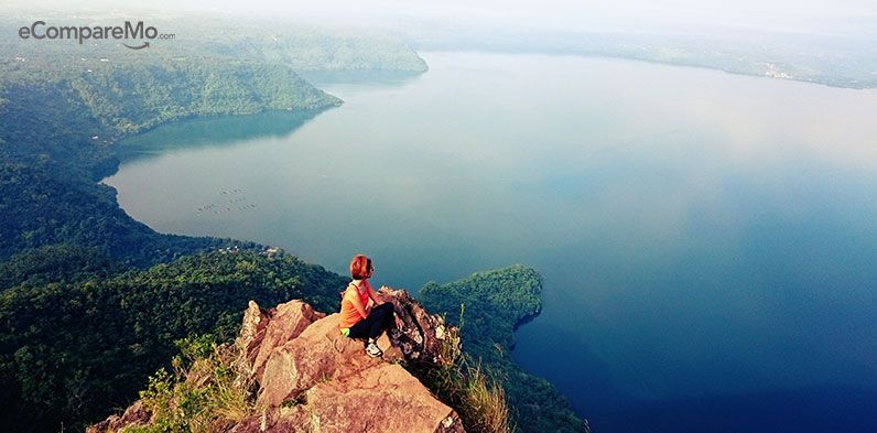
Considered the highest peak in Luzon and the third highest in the whole country, Mt. Pulag was coined the “playground of the gods†by the native tribes.
The slopes of this mountain are covered with vast forests filled with moss and pines. It is also home to different endangered species such as the dwarf bamboo, and the serpent eagle, the Philippine Deer, the Philippine pig, and the cloud rat.
And of course, there are the famous grasslands approaching the summit, which used to be filled with dwarf bamboo. We can only hope that the area has recovered from the fire caused by irresponsible tourists last January.
How to get there:
Via public transportation:
- Ride a bus from Buendia or Cubao bound for Baguio City.
- Take the jeepney ride going to Ranger Station or a public bus in Dangwa, Baguio then habal-habal to Ranger Station.
Via private transportation:
- Drive your way through NLEX then take the exit to SCTEX.
- From SCTEX, continue driving to TPLEX and then take Pozorrubio Exit.
- From Pozorrubio Exit, turn left and drive straight to Kennon road heading to Baguio
- From Baguio City proper, take road to Kabayan via Itogon.
Sample itinerary:
| Time | Activity |
|---|---|
| Day 0 | |
| 11:00 PM | Estimated time of departure from Manila |
| Day 1 | |
| 5:00 AM | Estimated time of arrival at Baguio City. Take breakfast then proceed to jeepney terminal or chartered jeep. |
| 7:00 AM | Ride chartered jeepney bound to Ambangeg. |
| 10:00 AM | Estimated time of arrival at Visitors’ Center |
| 11:30 AM | Jeepney ride to Ranger Station |
| 12:30 PM | Estimated time of arrival at the Ranger Station. Take lunch. |
| 1:00 PM | Begin trek |
| 2:30 PM | Estimated time of arrival at Camp 1 |
| 4:00 PM | Estimated time of arrival at Camp 2 |
| 6:00 PM | Dinner at campsite |
| Day 2 | |
| 4:30 AM | Begin trek to the summit |
| 5:45 AM | Estimated time of arrival at the summit |
| 7:00 AM | Begin descent from the summit. |
| 8:00 AM | Estimated time of arrival back at Camp 2. Take breakfast. |
| 9:00 AM | Begin descent and head back to Ranger Station |
| 11:30 AM | Estimated time of arrival at Ranger Station |
| 12:30 AM | Estimated time of arrival at the visitor’s center. Wash-Up and preparation. |
| 2:00 PM | Jeepney ride back to Baguio City |
| 5:00 PM | Estimated time of arrival at Baguio City |
| 6:00 PM | Bus ride back to Manila |
| 2:00 AM | Estimated time of arrival in Manila |
Expenses:
Estimated budget: If DIY P2,000 – P3,000
For guided tours: P3800 and up
9. Mt. MakilingÂ
Difficulty: 5/10
Jump Off: Station 1, UP College of Forestry
Hike: 4 to 5 hours to summit 2-3 hours down
Water load: At least 2 liters

Who isn’t familiar with the legendary Mt. Makiling? It has inspired numerous tales and poems regarding its mystical dweller and protector — the ever famous, Maria Makiling.
According to some legends, the outline of the mountain depicts that of Maria Makiling in a sleeping position. It is even published as an article in La Solidaridad by our national hero, Dr. Jose Rizal.
Mt. Makiling offers plenty of surprises for each and every hiker in the background. A stretch of well-preserved forests and wildlife make the hike more interesting, ending it with a peek of Los Baños with its neighboring towns, as well as that of Laguna Lake.
How to get there:
Via public transportation:
- Ride a bus from Buendia or Cubao bound to Los Baños Crossing
- Walk to ‘El Danda’ situated beside Robinson’s Mall.
- Ride the jeepney to UP College of Forestry.
Via private transportation:
- Drive through SLEX and take Calamba Exit.
- Follow the National Highway then make a right turn at Los Baños Crossing
- Enter at UPLB College of Forestry. Ask for the trailhead, where you can park. You can even go all the way to the Nursery if it’s not muddy
Sample itinerary:
| Time | Activity |
|---|---|
| 4:30 AM | Estimated time of departure from Manila |
| 6:30 AM | Estimated time of arrival at Los Baños Crossing. Walk to “El Danda†beside Robinson’s Place to take the jeepney ride to the Forestry. |
| 7:00 AM | Estimated time of arrival at the jump-off point. |
| 7:30 AM | Start trek |
| 8:45 AM | Estimated time of arrival at the Nursery |
| 9:00 AM | Begin trek to Peak 2 |
| 10:15 AM | Estimated time of arrival at the last campsite |
| 11:30 AM | Estimated time of arrival “90 degrees†|
| 12:00 PM | Estimated time of arrival Peak 2. Take lunch |
| 1:00 PM | Begin descent |
| 4:00 PM | Estimated time of arrival at the Nursery. Proceed to Mudspring as a sidetrip. |
| 4:20 PM | Estimated time of arrival at the Mudspring. Photo-Op. |
| 4:45 PM | Descent back to the Nursery then walk back to the jump-off at the jump-off. Walk down the road and wait for the jeepney. |
| 6:00 PM | Estimated time of arrival back at crossing |
| 7:30 PM | Bus ride back to Manila |
Expenses:
Estimated budget: P550 – P850
10. Mt. ArayatÂ
Difficulty: 5/10
Jump Off: Brgy. Ayala, Magalang, Pampanga
Hike: 5 to 7 hours
Water Load: At least two liters
Believed to be home to the legendary Mariang Sinukuan or Apu Sinukuan, this extinct volcano rising from the plains of was once regarded as sacred by many.
Mt. Arayat is surrounded by many fantastical stories and considered a promising hiking destination, which justifies its position as one of the Top 20 Best Hiking Spots in the Philippines.
How to get there:
Via public transportation:
- Take a bus ride at Five Star bus station bound to Angeles City.
- Alight at Marquee Mall.
- From there, ride the jeepney bound to Magalang, Pampanga. Alight at Brgy. Ayala/Banal na Bundok tricycle terminal.
- Ride the tricycle and alight at the DENR Registration Area.
Via private transportation:
- Drive your way through NLEX and take San Simon Exit.
- Turn right at Santa Ana -> Mexico -> San Luis -> San Simon Road
- At the roundabout take the third exit, J A Santos Ave (JASA)
- Turn left at Mt. Arayat National Park Road
Sample itinerary:
| Time | Activity |
|---|---|
| 3:30 AM | Estimated time of departure from Manila |
| 5:40 AM | Estimated time of arrival at the jump-off or registration area |
| 6:20 AM | Begin trek |
| 8:05 AM | Estimated time of arrival at White Rock. Photo-Op. |
| 9:00 AM | Resume trek |
| 9:50 AM | Estimated time of arrival at the North Peak (Summit 1) |
| 11:15 AM | Estimated time of arrival at Haring Bato. Continue trek. |
| 12:15 PM | Estimated time of arrival at South Peak (Summit 2). Photo-Op. |
| 1:30 PM | Resume trek |
| 3:20 PM | Estimated time of arrival at exit point. Wash-Up. |
| 5:00 PM | Estimated time of departure from Pampanga |
| 7:00 PM | Estimated time of arrival in Manila |
Expenses:
| Expense | Amount |
|---|---|
| Roundtrip bus fare | P250 |
| Jeepney fare from Dau to Balibago | P9 |
| Tricycle fare from Balibago to Marquee Mall | P50 for 2 pax |
| Jeepney fare from Marquee Mall to Magalang | P30 |
| Tricycle fare from Magalang to Brgy. Ayala | P120 for 3 pax |
| Guide Fee | P1,500 for 7 pax |
| Tricycle fare from San Juan Baño to Arayat Proper | P50 for 3 pax |
| Jeepney fare from Arayat Proper to SM City Pampanga | P27 |
| TOTAL | P650 |
11. Mt. HalconÂ
Difficulty: 10/10
Jump Off: Lantuyan, Baco, Oriental Mindoro
Hike: 18 to 20 hours
Water Load:Â At least 2 liters
Standing tall at Mindoro Island, Mt. Halcon is one of the most majestic mountains found in the Philippines. It features long and steep trails running through dense jungle and translucent waters brought about by its pristine rivers.
Take note that Halcon is considered one of the hardest climbs in the Philippines and should never be attempted without some serious training and without hiring local guides. Also, climbs in Halcon are strictly regulated and only allowed from February to May, make sure you procure the proper permits at the correct times.
How to get there:
Via public transportation:
- Ride a bus at Buendia Bus Station bound to Batangas Pier.
- Ride the ferry at Batangas Pier to Calapan, Oriental Mindoro.
- Rent a jeepney at Calapan to Baco Municipality (Roundtrip)
Sample itinerary: Â
| Time | Activity |
|---|---|
| Day 1 | |
| 12:00 AM | Estimated departure time from Manila |
| 2:00 AM | Estimated arrival time at Batangas Pier |
| 4:00 AM | Estimated departure time of roro |
| 6:00 AM | Estimated arrival time of roro at Port of Calapan, Mindoro Oriental |
| 6:15 AM | Estimated departure time of Jeepney bound to Baco. Breakfast on the way. |
| 8:00 AM | Estimated time of arrival at Baco |
| 9:00 AM | Processing of permits at Baco Tourism Office |
| 10:00 AM | Personal appearances at the Baco Police Station |
| 11:00 AM | Estimated time of departure for the jump-off point. Take lunch on the way. |
| 12:00 PM | Estimated time of arrival at the jump-off point |
| 1:00 PM | Final preparations |
| 2:00 PM | Begin trek |
| 7:00 PM | Estimated time of arrival at Unang Dungaw |
| 7:00 PM — 8:30 PM | Rest. Have dinner. Set camp. |
| 8:30 PM | Lights out |
| Day 2 | |
| 6:00 AM | Wake-up call |
| 7:00 AM | Take Breakfast |
| 8:00 AM | Estimated time of departure from Unang Dungaw. |
| 11:30 AM | Estimated time of arrival at Balubag Baboy |
| 12:00 PM | Take lunch |
| 12:45 PM | Estimated time of departure from Balubag Baboy |
| 2:45 PM | Estimated time of departure at Camp 2 |
| 3:00 PM | Free time |
| Day 3 | |
| 3:00 AM | Wake-up call |
| 4:00 AM | Begin trek |
| 5:20 AM | Estimated time of arrival at the summit. Photo-Op. |
| 7:40 AM | Begin descent |
| 9:40 AM | Estimated time of arrival at Camp 2. Photo-Op then proceed trek. |
| 11:00 AM | Estimated time of arrival at Dulangan River. Free time. |
| 12:00 PM | Proceed with trek |
| 12:40 PM | Estimated time of arrival at Apalaya Campsite |
| 1:00 PM onwards | Free time |
| Day 4 | |
| 7:00 AM | Call time. Eat breakfast. |
| 9:00 AM | Begin descent |
| 12:30 PM | Estimated time of arrival at Basketball Court/Buko Station. Take Lunch. |
| 1:30 PM | Begin descent |
| 2:00 PM | Estimated time of arrival at the Jump-off point. Wash-Up and preparation. |
| 7:00 PM | Call time. Eat dinner and proceed to Port of Calapan. |
| 12:00 PM | Board RORO from Calapan, Mindoro Oriental to Batangas Pier |
Expenses:
Estimated Budget: P1500 – P2200 per pax for 4 days, for a group of 7
12. Mt. TarakÂ
Difficulty: 5/10
Jump Off: Brgy. Alas-asin, Mariveles
Hike: 5 to 6 hours
Water Load: At least 2 liters
Out of all the peaks and ridges Mariveles has to offer, Mt. Tarak is popularly known as the perfect mountain climbing destination.
Mt. Tarak’s magnificent trail offers panoramic views of the Manila Bay and its islands, as well as the distant mountains of Cavite. You can never go wrong with the picturesque view of the rocky cliffs perfect for your “Instagram-worthy†upload.
You can also take a breather at Papaya River, which is the last stop before reaching the summit.
How to get there:
Via public transportation:
- From Cubao Bus Station, ride a bus bound to Mariveles, Bataan.
- Alight at Brgy. Alas-asin.
- You can start walking up to Tarak Ridge the from the main highway or take a tricycle to a nearer jump-off point to save some time and energy.
Via private transportation:
- If you’re driving from Manila, drive through North Luzon Expressway (NLEX). You can take either San Fernando toll exit or the Subic-Clark-Tarlac Expressway (SCTEX).
If Via San Fernando Toll Exit:
- Upon exiting at San Fernando, proceed to Jose Abad Santos Ave, (formerly Olangapo-Gapan Road) then drive all the way to Lubao Pampanga and Dinalupihan Bataan.
- At the Layac junction, take the road leading to Roman Super Highway on the left (right turn leads to Olangapo City) then drive all the way to the City Center of Balanga, Bataan.
If Via SCTEX:
- Via SCTEX, take the Dinalupihan exit and turn right at Roman Super Highway.
- Follow the main road and make your way to Mariveles. You need to pass by the Brgy. Hall to register prior to your climb.
You can park your vehicle in a rest area near the jump-off point. Locals have converted their houses into a base for mountaineers. There are sari-sari stores there where you can buy water and last-minute supplies. You’ll also find cheap lodging there, and pay restrooms where you can wash up after your climb.
Sample itinerary:
| Time | Activity |
|---|---|
| 4:30 AM | Estimated departure time from Bataan Transit Cubao terminal |
| 7:30 AM | Estimated arrival time at Alas Asin Barangay Hall. Register. |
| 8:00 AM | Estimated time of arrival at Aling Cording’s hut. Register and give donation. |
| 8:20 AM | Begin trek |
| 9:40 AM | Estimated time of arrival at Papaya River. Take early lunch. |
| 10:00 AM | Begin ascent to the ridge |
| 11:45 AM | Estimated time of arrival at Tarak Ridge |
| 1:00 PM | Begin descent |
| 2:00 PM | Estimated time of arrival at Papaya River |
| 3:20 PM | Estimated time of arrival back at the jump-off. Wash-up. |
| 5:00 PM | Estimated time of departure from the jump-off |
| 8:30 PM | Estimated time of arrival at waiting shed. Catch bus back to Manila |
Expenses:
| Expense | Amount |
|---|---|
| Roundtrip Bus fare | P544 |
| Registration fee | P40 |
| Toilet and bath fee | P20 |
| Tour Guide Fee | P900 (OPTIONAL) |
| TOTAL | P604 + optional tour guide fee |
13. Gulugud Baboy (Mt. Pinagbanderahan)
Difficulty: 3/10
 Jump Off: Philpan Dive Resort, Anilao, Mabini
Hike: 1.5 to 3 Hours
Water Load: At least 2 liters
Southern Batangas is more known for the diving resorts in Anilao, the birthplace of the Filipino scuba diving community. Since then, diver and other outdoor enthusiasts have discovered that Anilao offers more than adventure under the sea.
Anilao is also home to the hiking destination, known as the Gulugod Baboy Trail. Rolling hills, sprawling grasslands and a 360-degree view of the coastal waters
An easy hike but one that ends in some stunning views, there’s also the option of going to the beach afterward.
How to get there:
Via public transportation:
- From Buendia or Cubao Bus Station, ride a bus bound to Batangas and alight at the Batangas Grand Terminal.
- From there, ride a jeepney going to Anilao, Batangas and alight at the Philpan-Mabini Junction.
- Ride a tricycle going to the registration site of Mt. Gulugod Baboy.
 Via private transportation:
- Drive your way through the South Luzon Expressway (SLEX) and take Osmeña Exit.
- At the roundabout, take the second exit, Bolboc Access Road.
- Turn right at Bauan – Batangas Provincial Road
- Make a right turn at Buendia and then left on Bauan-Mabini Road.
- Take Mabini Circumferential Road to Philpan Dive Resort.
Sample itinerary:
| Time | Activity |
|---|---|
| 4:00 AM | Estimated departure time from Manila |
| 5:00 AM | Estimated arrival time at Batangas Grand Terminal |
| 6:00 AM | Estimated time of arrival at PhilPan – Mabini Junction |
| 6:30 AM | Estimated time of arrival at the registration site. Take breakfast |
| 7:30 AM | Begin trek |
| 10:00 AM | Estimated time of arrival at the summit. Photo-op. |
| 11:00 PM | Begin descent |
| 1:00 PM | Estimated time of arrival at they jump-off. Free time |
| 6:00 PM | Catch a bus back to Manila |
| 9:00 PM | Estimated time of arrival back in Manila |
Expenses:
| Expense | Amount |
|---|---|
| Roundtrip Bus fare | P314 |
| Roundtrip Grand Terminal — PhilPan fare | P70 |
| Roundtrip Tricycle Philpan — Registration fare | P80 |
| Registration fee | P30 |
| Tour Guide Fee | P500 for 4 pax |
| TOTAL | P619 |
(Read:Â Â Best Affordable Beach Resorts In Batangas)
14. Mt. ManalmonÂ
Difficulty 3/10
Jump off: Sitio Madlum, Brgy. Sibul San Miguel Bulacan
Hike: 2.5 to 4 hours
Eager to try mountain climbing but are reluctant to take a difficult hike? Take a trip to Mt. Manalmon of San Miguel, Bulacan. This place is great for beginners.
Prepare to reconnect with nature as you make your way to the peak of this beautiful mountain. Mt. Manalmon is also part of the Biak-na-Bato trail, so your trekking in the footsteps of our brave ninunong Katipuneros.
How to get there:
Via public transportation:
- At Cubao Bus Terminal Balagbag Transit, ride a bus bound to Gapan, particularly the bus with the signage of San Miguel.
- Alight at Kamias Crossing/Junction.
- From Kamias Crossing/Junction, ride a tricycle to Biak Na Bato Natural Park.
Via private transportation:
- Drive your way through North Luzon Expressway (NLEX) and take Sta. Rita Exit.
- Follow the road to Cagayan Valley, passing by Plaridel -> Pulilan -> Baliuag -> San Rafael and San Ildefonso, Bulacan.
- At San Miguel, ask directions for Brgy. Madlum – which is 30 minutes away.
Sample itinerary:
| Time | Activity |
|---|---|
| 3:00 AM | Estimated departure time from Manila |
| 5:00 AM | Estimated arrival time at Kamias Junction |
| 5:45 AM | Estimated time of arrival at Biak na Bato Park. Take breakfast |
| 6:45 AM | Registration |
| 7:00 AM | Begin trek |
| 8:00 AM | Estimated time of arrival at the viewpoint |
| 9:00 AM | Estimated time of arrival at the summit |
| 10:00 AM | Begin descent |
| 11:00 PM | Estimated time of arrival at the jump off. Wash—Up. |
| 12:00 PM | Take lunch |
| 1:00 PM | Proceed to caves |
| 2:00 PM | Back to the junction |
| 3:00 PM | Estimated time of arrival at the junction |
| 4:00 PM | Ride home |
| 6:00 PM | Estimated time of arrival in Manila |
Expenses:
| Expense | Amount |
|---|---|
| Roundtrip Bus fare | P234 |
| Roundtrip Tricycle fare | P240 for 3 pax |
| Registration fee | P20 |
| Environmental Fee | P10 |
| Tour Guide Fee | P300 for 9 pax |
| TOTAL | P459 |
15. Mt. Pamitinan
Difficulty: 4/10
Jump Off: Brgy. Wawa, Rodriguez, RIzal
Hike: 2 to 3 hours
Unleash your inner strength and discover Mt. Pamitinan in Rodriguez, Rizal.
Although it offers a challenging trail for first-time hikers, you wouldn’t want to miss the breathtaking view that awaits your eyes as you reach the summit of this majestic mountain.
Its landscape is mostly made up of limestones, something that’s sure to pique your interest. If that’s not enough, maybe the stories of how this area was used as a hideout during the Spanish Era will make this trek one you’ll really remember.
How to get there:
Via public transportation:
- From Cubao, you can ride a UV Express in from of Gateway Mall. Alight in Eastwood Subdivision in front of Ministop.
- From there, ride a tricycle to Sitio Wawa and alight at the DENR Registration area.
Via private transportation:
- Drive your way to Rodriguez, Rizal via Marikina and San Mateo.
- Follow the road to Wawa Dam. Parking slots are available in front of the tourism office.
Itinerary:
| Time | Activity |
|---|---|
| 2:30 AM | Estimated time of departure from Cubao |
| 3:00 AM | Estimated time of arrival at Eastwood |
| 4:15 AM | Estimated time of arrival at Brgy. Wawa |
| 4:30 AM | Registration |
| 4:45 AM | Begin trek |
| 5:30 AM | Estimated time of arrival at the junction |
| 5:45 AM | Assault to summit |
| 6:15 AM | Estimated time of arrival at Peak 1. Photo-Op |
| 6:45 AM | Estimated time of arrival at Peak 2. Photo-Op |
| 7:00 AM | Begin descent |
| 8:30 AM | Estimated time of arrival at the jump-off. Wash-Up |
| 9:00 AM | Take breakfast |
| 10:00 AM | Estimated time of arrival at Wawa Dam. Photo-Op |
| 12:00 PM | Take lunch |
| 1:00 PM | Begin trek to Karugo falls |
| 2:00 PM | Estimated time of arrival at Karugo Falls |
| 4:00 PM | Back to jump-off |
| 5:00 PM | Estimated time of arrival at the jump-off. Ride home. |
| 7:00 PM | Estimated time of arrival in Manila |
Sample expenses:
| Expense | Amount |
|---|---|
| Roundtrip UV Express Fare Cubao – Eastwood | P100 |
| Roundtrip Tricycle fare Eastwood – Sitio Wawa | P60 for 3 pax |
| Registration fee | P30 |
| Lunch | P150 |
| Tour Guide Fee | P300 for 9 pax |
| TOTAL | P420 |
16. Mt. Apo
Difficulty: 8/10
Jump Off: Brgy. Ilomavis, Kidapawan City
Hike : 10 to11 hours
Water Load: At least 5 liters
The highest peak in the Philippines, Mt. Apo is known as the “Grand Father†of all the Philippine mountains, and a dream to conquer for every Filipino mountaineer.
Considered a major climb, Apo’s panoramic views and diverse scenery will surely leave you mesmerized. A marvelous sight to behold!
How to get there:
From Manila:
- Book flight going to Davao City.
- From the airport, ride a van going to Kidapawan City.
Sample itinerary:
| Time | Activity |
|---|---|
| Day 1 | |
| 5:00 AM | Take van from Davao City to Kidapawan City |
| 7:30 AM | Estimated time of arrival at Kidapawan City. Registration |
| 8:30 AM | Proceed to Brgy. Ilomavis |
| 10:00 AM | Estimated time of arrival at Brgy. Ilomavis. Begin trek |
| 1:00 PM | Estimated time of arrival at Mainit Hot Springs |
| 5:00 PM | Estimated time of arrival at Lake Venado. Set up camp |
| Day 2 | |
| 4:00 AM | Wake up. Eat Breakfast |
| 5:00 AM | Begin summit assault |
| 8:00 AM | Estimated time of arrival at the summit of Mt. Apo |
| 10:00 AM | Begin descent to Lake Venado |
| 12:30 PM | Estimated time of arrival at Lake Venado. Begin trek to Bobbong campsite |
| 6:00 PM | Estimated time of arrival at Bobbong campsite |
| 7:00 PM | Dinner. Rest. |
| Day 3 | |
| 6:00 AM | Wake up. Eat Breakfast |
| 8:00 AM | Begin descent to Bongolanon falls |
| 12:00 PM | Estimated time of arrival Bongolanon Falls. Take lunch. |
| 1:00 PM | Back to Kidapawan City |
| 3:00 PM | Estimated time of arrival at Kadipawan City |
| 6:00 PM | Estimated time of arrival at Davao City |
Expenses :
Varies. Mostly due to the variability of the ticket prices of a flight from Manila to Davao.
17. Mt. Kupapey
Difficulty: 4/10
Jump-Off: Maligcong, Bontoc, Mountain Province
Hike: 8 –10 hrs
Water Load : At least 2 liters
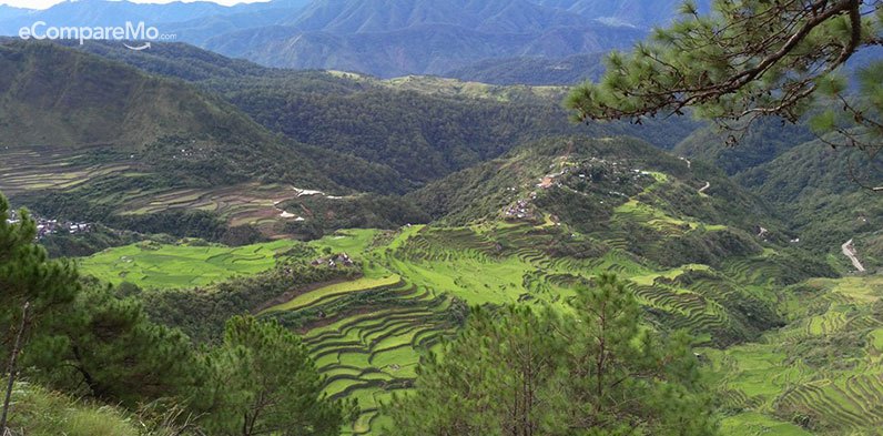
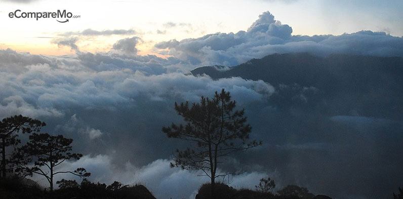
The city of Bontoc has long been overshadowed by neighboring cities Banaue and Sagada. But it’s gradually starting to show its beauty to the growing numbers of tourists who have come to see it. One thing you must see and hike is Mr. Kupapey
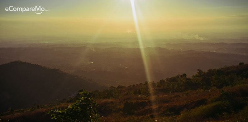
If you are in for an adventure, start hiking just before dawn to witness the sea of clouds at the summit. You’re bound to get there just as the sun peaks above the horizon. Truly a breathtaking experience.
How to get there:
Via public transportation:
- At Cubao or Buendia Bus Station, ride a bus bound to Baguio City.
- Alight at Victory Bus Station in Baguio City and then take a cab to Slaughterhouse.
- Ride the Rising Sun bus bound to Bontoc.
- Ride the jeepney going to Maligcong.
Sample itinerary:
| Time | Activity |
|---|---|
| Day 0 | |
| 11:00 PM | Estimated time of departure from Manila |
| Day 1 | |
| 5:00 AM | Estimated time of arrival in Baguio |
| 6:30 AM | Estimated time of departure from Baguio |
| 8:00 AM | Stop Over at Halsema Highway Marker |
| 12:00 PM | Estimated time of arrival at Maligcong |
| 3:00 PM | Begin trek to Mt. Fato |
| 4:30 PM | Estimated time of arrival at summit |
| 5:00 PM | Begin descent |
| 6:30 PM | Estimated time of arrival at homestay |
| Day 2 | |
| 3:30 AM | Wake up. Eat Breakfast |
| 3:45 AM | Begin trek |
| 5:30 AM | Estimated time of arrival at the summit |
| 7:00 AM | Begin descent |
| 8:00 AM | Begin detour to Maligcong Rice Paddies Trail |
| 9:00 AM | Estimated time of arrival at homestay |
| 10:00 AM | Departure for Baguio |
| 5:00 PM | Estimated time of arrival at Baguio City |
| 11:00 PM | Estimated time of arrival in Manila |
Expenses:
| Expense | Amount |
|---|---|
| Roundtrip Bus Fare | P900 |
| Van Fare from Bontoc to Banaue | P200 |
| Jeepney fare from Maligcong to Bontoc | P20 |
| Barangay Entrance Fee | P20 |
| Homestay | P350 |
| Meals | P120 for 2 pax |
| Guide Fee | P500 |
| Towel rental | P20 |
| TOTAL | P2,250 |
(Read:Â 5 Extreme Sports Activities Around The World For The Adventurous Tourist)
18. Mts. Maynoba and Cayabu
Difficulty 4/10
Jump Off: Brgy. Cayabu, Tanay Rizal
Hike: 2 to 3 hours
Water Load: At least 2 liters
If you want to experience seeing the marvelous view of the sea of clouds, lace up your hiking boots and head to Mts. Maynoba and Cayabu in Tanay, Rizal.
Apart from the convenient fact that it is near Manila, another reason to hike this mountain is the natural beauty that awaits you as you trek your way up. Enjoy the stunning view of the Sierra Madre mountain ranges, and the pristine waterfalls that Mt. Maynoba-Cayabu trail has to offer.
How to get there:
Via public transportation:
- Ride the jeepney at Sampaloc bound to Cogeo
- Ride the jeepney from Cogeo bound to Batangasan
- Ride the tricycle from Batangasan junction to the trailhead
Via private transportation:
- Drive your way through Marcos Highway until you reach Brgy. Cuyumbay.
- Turn left then follow the road until you reach the trailhead.
Sample itinerary:
| Time | Activity |
|---|---|
| 3:00 AM | Estimated time of departure from Manila |
| 4:00 AM | Estimated time of arrival at Antipolo. Ride jeepney bound to Batangasan junction. |
| 5:00 AM | Estimated time of arrival at Batangasan junction. Take tricycle to Brgy. Cayabu. |
| 5:30 AM | Estimated time of arrival at Maynoba trailhead, Brgy. Cayabu. Registration. |
| 6:00 AM | Begin trek |
| 7:00 AM | Estimated time of arrival at Mt. Cayabu |
| 8:00 AM | Estimated time of arrival at Mt. Maynoba Viewpoint |
| 8:30 AM | Proceed with the loop hike |
| 9:30 AM | Pass through the eight waterfalls |
| 10:30 AM | Continue trek back to the trailhead |
| 12:00 PM | Estimated time of arrival back at Brgy. Cayabu trailhead. Take lunch. |
| 2:00 PM | Ride back to Manila |
| 4:30 PM | Estimated time of arrival in Manila |
Expenses:
Estimated Expenses: P400 – P500
19. Mt. Balagbag
Difficulty: 3/10
Jump Off: Sitio Karahume, Brgy. Macabud, Rodriguez
Hike: 1 to 2 hours
See the city from a distance as you make your way up to Mt. Balagbag. This mountain offers views of Ortigas and some parts of Metro Manila.
It is an easy trail and a cult favorite of hikers as well as mountain bikers. Additional features of this day trip include pristine waterfalls and rivers and the Veteran’s Peak or Veteran’ Summit, a famous local tourist spot.
How to get there:
Via public transportation:
- Ride a Van in Cubao or PhilCoa bound to Tungko
- Take the jeepney ride in Tungko boun to Licao—Licao
- Ride tricycle from Licao—Licao to Sitio Balagbag (OPTIONAL)
Via private transportation:
- Drive your way to Rodriguez, Rizal until you reach Brgy. Macabud.
- An uphill road will take you to the Licao—Licao area.
- Drive all the way up until you reach Sitio Balagbag.
Sample itinerary:
| Time | Activity |
|---|---|
| 5:00 AM | Estimated time of departure from Jollibee Tungko to Karahume or Licao-Licao |
| 6:00 AM | Estimated time of arrival from Karahume or Licao-Licao |
| 7:00 AM | Explore the waterfalls from Karahume |
| 10:30 AM | Begin trek to the summit |
| 12:00 PM | Estimated time of arrival at the summit |
| 1:00 PM | Descent back down to Licao-Licao |
| 3:00 PM | Estimated time of arrival back at the jump-off. Ride back to Manila. |
| 6:00 PM | Estimated time of arrival back in Manila |
Expenses:
| Expense | Amount |
|---|---|
| Roundtrip Van Fare | P110 |
| Roundtrip Jeepney Fare | P60 |
| Registration fee 1 and 2 | P30 |
| Food | P100 |
| TOTAL | P300 |
20. Mt. Guiting-Guiting
Difficulty 10/10
Jump Off : Brgy. Tampayan, Madgiwang, Sibuyan
Hike: 10 to 13 hours
Dubbed by some as the “Galapagos of Asiaâ€, Mt. Guiting-Guiting features forests of abundant vegetation.
You won’t have to deal with freezing temperatures here, unlike in Mt. Pulag and Mt.Apo. The trail is rocky and treacherous, but both local and international mountaineers find this trek a huge yet rewarding climb.
How to get there:
Via public transportation
- At Buendia Bus Station, ride Greenstar Liner Bus bound to Batangas port.
- Secure tickets to Ambulong Port bound to Magdiwang
Check ferry rides of MBRS Lines or Super Ferry at North Harbor for availability and schedule.
Itinerary:
| Time | Activity |
|---|---|
| Day 0 | |
| 8:30 AM | Estimated time of departure from Buendia Bus Station to Batangas port |
| 12:00 PM | Estimated time of arrival at Batangas port |
| 5:00 PM | Ferry ride to Magdiwang Port |
| Day 1 | |
| 8:00 AM | Estimated time of arrival at Magdiwang (Ambulong Port) |
| 8:15 AM | Registration |
| 9:00 AM | Take breakfast |
| 10:00 AM | Preparation |
| 11:00 AM | Head to Tansiungco Residence or Sanctuary Lodge |
| 12:00 PM | Prepare for the climb |
| 9:00 PM | Lights out |
| Day 2 | |
| 6:00 AM | Wake-up call. Take breakfast |
| 7:30 AM | Begin trek |
| 10:30 AM | Estimated time of arrival at Camp 1 |
| 12:00 PM | Estimated time of arrival at Camp 2. Take lunch |
| 2:00 PM | Estimated time of arrival at Camp 3 |
| 2:30 PM | Estimated time of arrival at Bulod’s spring |
| 3:00 PM | Estimated time of arrival at Mayo’s Peak. Rest. |
| 5:00 PM | Sunset viewing at Mayo’s Peak |
| 7:00 PM | Dinner |
| 8:00 PM | Lights out |
| Day 3 | |
| 5:00 AM | Wake up. Take breakfast |
| 6:00 AM | Begin trek |
| 6:30 AM | Crossing the “Knife edge†|
| 8:00 AM | Estimated time of arrival at “Kiss the Wall†|
| 9:30 AM | Estimated time of arrival at Mabel Spring |
| 10:15 AM | Estimated time of arrival at the Peak of Deception |
| 11:00 AM | Estimated time of arrival at G2 Summit |
| 12:00 PM | Descent |
| 4:00 PM | Estimated time of arrival back at Mayo’s Peak |
| 6:00 PM | Dinner |
| Day 4 | |
| 7:00 AM | Wake up. Take breakfast |
| 8:00 AM | Preparation |
| 9:00 AM | Begin descent |
| 2:00 PM | Estimated time of arrival back at jump-off |
Expenses:
| Expense | Amount |
|---|---|
| Roundtrip Transportation Fee | P3480 |
| DENR Registration Fee | P300 |
| Accommodation and Lodging | P600 per day for 3 pax |
| Guide Fee | P3000 for 3 pax |
| Porter fee | P1800 for 3 pax |
| TOTAL | P6,380 |
SOURCES:
http://www.pinoymountaineer.com/2007/08/tarak—ridge—1130.html
http://thenovicetrekker.blogspot.com/2018/02/mt—mariveles—bataan—tarak—ridge—1006.html
http://www.trailadventours.com/philippine—mountains/tarak—ridge
http://itinerary.ph/travel—guide—mt—mariveles—tarak—ridges—sweet—assault/
http://www.mtapoadventures.com/about—the—mountain/
About the author
Cloey Mangali Cloey was a dentistry student before she found her true calling. After writing digital content for several publications, she now churns out financial advice and lifestyle pieces on eCompareMo. She is also a certified travel junkie, novel geek, and sports enthusiast.